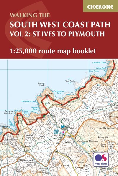
01841 533804  

South West Coast Path Map Booklet St Ive

£12.95

Map of part of the southern section of the 630 mile (1014km) South West Coast Path National Trail. Covers the trail from St Ives to Plymouth along the west Cornwall and Devon coastline. This convenient and compact booklet of Ordnance Survey 1:25,000 maps shows the route, providing all of the mapping you need to walk the trail in either direction.

In stock

SKU: 9781852849375 Category: Tags: ,

Description

This booklet of Ordnance Survey 1:25,000 Explorer maps covers part of the southern section of the route between St Ives and Plymouth, providing all the mapping you need to walk the trail in either direction. It is conveniently sized for slipping into a jacket pocket or top of a rucksack. Two separate booklets cover the rest of the route, from Minehead to St Ives and from Plymouth to Poole. The map booklet accompanies the Cicerone guidebook The South West Coast Path, which describes the full National Trail in 45 stages, with lots of other practical information and local points of interest. The South West Coast Path is Britain’s longest National Trail, stretching some 630 miles (1014km) between Minehead in Somerset and Poole in Dorset.

Additional information

Weight 0.102 kg
Dimensions 17.2 × 12.9 × 0.55 cm
Author

Publisher

Imprint

Cover

Paperback

Pages

88

Language

English

Edition
Dewey
Readership

General – Trade / Code: K