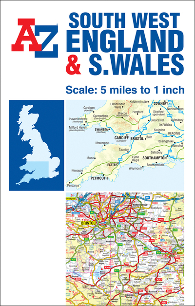
Description
The Great Britain Road Map series comprises of five fold-out sheet maps which together cover the whole of Great Britain. Shown at a scale of 5 miles to 1 inch and using a continuous grid referencing system, it enables several or all of the sheets to be mounted together, whilst retaining index compatability.This A-Z Map ofSouth West England and South Wales is a full colour, single-sided, fold-out road map featuring continuous mapping south of Aberystwyth and Coventry and to the west of Kettering and Chichester. Also included is an inset map of the Isles of Scilly.Instantly recognizable and easy to use, A-Z road mapping includes the following features:?Clear standard road classification colours for easy identification?Full motorway junction detail?Under construction and proposed roads?Primary route destinations?Service areas?Hill shading sourced from Geo-Innovations+ www.geoinnovations.co.uk?National and County boundaries?A wide range of tourist and ancillary information, including Blue Flag Beaches.An index booklet is attached to the cover listing cities, towns, villages, hamlets and locations featured on the map.